Difference between revisions of "Welcome to Urban Securipedia"
Jump to navigation
Jump to search
Search by specific keyword:
m (Text replace - " " to " ") |
|||
| Line 1: | Line 1: | ||
| + | <div id="header"> |
||
| − | [[Category:Top category]] |
||
| ⚫ | |||
| − | = {{PAGENAME}} = |
||
| − | Securipedia is an |
+ | Securipedia is an urban security (and connected safety) knowledge base which forms part of a complimentary tool with the objective of assisting and supporting the urban planner to make more informed deliberations and decisions on the proper planning and sustainable development of the urban area, from a security (and connected safety) perspective. |
| + | Urban Securipedia has been developed with the end-user in mind and accordingly a number of starting points are possible: |
||
| ⚫ | |||
| + | </div><div id="main-container"><div id="container-left"><div id="main"><div id="miniheader">'''1. Enter by urban function/issue '''<br /> (Select from below) </div><div id="images"> </div></div></div><div id="container-middle"><div id="main"><div id="miniheader">'''2. Enter by urban object type'''<br /> (Hover over different land uses below) </div><div id="clickablemaps">[[Image:clickmap.png]]</div></div></div><div id="container-right"><div id="main"><div id="miniheader">'''3. Enter by a specific keyword/crime type'''<br /> (And see top right of screen) </div><br /> Search by specific keyword: <div id="searchbar"> <br /></div><div id="bbox1">[[Image:fp7vitlogo.png]]</div></div></div></div><div id="footer"> |
||
| − | [http://www.vitruv-project.eu/ VITRUV] (Vulnerability Identification Tools for Resilience Enhancements of Urban Environments) is a project co-funded by the European Commission within the Seventh Research Framework Programme 2007-2013. This collaborative project seeks to incorporate appropriate security measures for [[vulnerability]] identification and [[resilience]] enhancements in [[urban planning]] practice. |
||
| ⚫ | |||
| − | While [[urban planning]] is a complex process with many [[stakeholders]] and [[Urban planner|multi-disciplinary teams]], the existing software tools do not include any comprehensive consideration of [[security]] (and connected [[safety]]) aspects of [[urban planning]] as a whole.<br /> |
||
| + | </div> |
||
| − | === Concept, Plan and Detail Level === |
||
| − | |||
| − | The urban planning process evolves from a rough, basic concept to a detailed, concrete design, and the VITRUV project provides tools for urban planning which can be applied across three stages of design, ranging from [[Concept level|concept]] to [[Plan level|plan]] to [[Detail level|detail]] level. Securipedia forms part of the toolkit applicable to the concept level, where well-considered systematic qualitative decisions should be made.<br /> |
||
| − | <br> |
||
| − | <imagemap> |
||
| − | Image:Urban Planning Levels.png|center|800px |
||
| − | |||
| − | circle 171 168 131 [[Concept level|concept level]] |
||
| − | circle 411 167 119 [[Plan level|Plan level]] |
||
| − | circle 661 165 140 [[Detail level|detail level]] |
||
| − | |||
| − | desc bottom-left |
||
| − | </imagemap> |
||
| − | |||
| − | ==The concept level tool== |
||
| − | CONTEXT: Departing from a concrete goal or problem, the first step in finding a fitting solution in the urban space is to investigate possible solution directions. This encompasses matching the needs from the problem with guidelines, strategies and legal obligations. In this stage of planning, the problem to be solved or goal to be reached is made explicit, possible solution paths are surveyed, and the solutions paths for further investigation in the process are selected. These are later considered in the plan level where possible solutions will be developed and, after selecting one (or more) solutions, worked out in the detail level. |
||
| − | |||
| − | GOAL: To provide an easy-to-use, computer assisted support for city planners in a systematic, qualitative way in order to make decisions with regard to the security of cities concerning concrete problems or goals. |
||
| − | |||
| ⚫ | |||
| − | |||
| − | ==== Risk Assessment tool (SecuRbAn) ==== |
||
| − | The Risk Assessment tool, a quick security scan to indicate where possible security issues may be, will facilitate the urban planner in making a quick assessment of the security issues that are most relevant to a project or scheme. An important aspect of the Risk Assessment tool is the timely manner in which the urban planner can eliminate the security issues that are not of interest in a specific project or scheme, in order to focus attention on relevant issues. The Risk Assessment is not intended to be very detailed or exhaustive in its assessment, and is intended to indicate possible security issues; the actual assessment is made by the user. The Risk Assessment will link with relevant pages, as appropriate, in the Knowledge Base to provide sufficient information about the security risks, their possible solutions and the impact upon other dimensions to allow urban planners to make well-considered decisions regarding security issues in their development process. |
||
| − | |||
| − | Risk Assessment Primary Output:<br /> |
||
| − | - Prioritised list of security issues deemed relevant for addressing the project;<br /> |
||
| − | - Links to relevant Knowledge Base pages;<br /> |
||
| − | - A complete list of all possible security issues indicating its relevance to the project (allows quick comparison to see the changes between two risk assessments.<br /> |
||
| − | |||
| − | ==== Knowledge Base (Securipedia) ==== |
||
| − | The Knowledge Base provides the background understanding on subjects that are directly or indirectly related to security for the urban planner. The Knowledge Base has been formulated having regard to the composition of the Urban Environment, which includes Urban Objects (with functions such as Mobility, Economy, Social and Safety etc), Legal and Ethical Aspects, and urban threats (means and motives). The Knowledge Base explains the relationships between the concepts, relevant to security assessment, for urban planners. For more information about the topics contained in the knowledge base, see [[structure of the knowledge base]]. |
||
| − | |||
| − | The Knowledge Base has been purposely designed to be user-friendly and intuitive; it does not provide specific advice about a project but simply provides advice about what subjects to address in the process, and how one can address these subjects. |
||
| − | |||
| − | Securipedia Knowledge Base Primary Output:<br /> |
||
| − | - The source of information on security issues highlighted by the Risk Assessment (with links to relevant pages in the Knowledge Base);<br /> |
||
| − | - A wider repository of information on subjects that are relevant to both the urban planning process and security;<br /> |
||
| − | - Links to outside sources where relevant information can be found that is beyond the level of detail that the Knowledge Base aims for.<br /> |
||
| − | |||
| − | ==== Applied Example of Concept Tool ==== |
||
| − | |||
| − | The city authority planning department has recognised that the public transport network has not developed in line with urban population growth and the rate of economic development. The planning department is investigating the suitability of a new tram line through the city connecting with existing bus and rail services at strategic locations to address a near chronic traffic congestion problem, and whether such a proposal would fit with the objectives of the City Integrated Land Use and Transportation Development Plan. |
||
| − | |||
| − | A range of additional factors need to be considered from the outset, including: |
||
| − | |||
| − | • mechanisms to stimulate demand to generate a modal shift in favour of public transport;<br /> |
||
| − | • consideration of future population growth zones (in particular residential and employment areas, which typically generate the highest transport demand);<br /> |
||
| − | • the regulatory framework (such as congestion pricing, removal of trucks from city areas etc); and,<br /> |
||
| − | • the security and safety aspects of the system, and its components (tram station design, locations, etc). |
||
| − | |||
| − | The VITRUV Concept Tool Risk Assessment and Knowledge Base provides the urban planner with two distinct functionalities. The first, the Risk Assessment tool, supports the planner in quickly assessing the security issues that are most relevant to the tram project (e.g. assessing the attractiveness of, say, the tram station, to different types of perpetrators, and the inherent vulnerabilities of different aspects of the facility etc; the effects of these vulnerabilities can then be identified). |
||
| − | |||
| − | The second functionality, the Knowledge Base, is a repository of information that shows the relevance of the security issues (from the Risk Assessment) in the context of the other factors considered by the urban planner. The tool therefore supports urban planners in making better-informed decisions regarding security issues (risk, possible solutions and their impact on other factors in urban planning).<br /> |
||
| − | |||
| − | ===Related projects=== |
||
| − | |||
| − | In its work, VITRUV considers approaches and results from the following related projects that have been identified so far. This in particular refers to broadening the prespective on [[Culture_aspects|culture]], [[Ethics_aspects|ethics]] and [[Legal_aspects|legal]] aspects of urban planning and methods to consider those aspects in a more comprehensive way. |
||
| − | |||
| − | * [[Related_projects:_PERIPHERIA|PERIPHERIA]] |
||
| − | * [[Related_projects:_DynASS|DynAss]] |
||
| − | * [[Related_projects:_Meet_the_Need|Meet the Need]] |
||
| − | * [[Related_projects:_PluS|PluS]] |
||
| − | * [[Related_project:_DESURBS|DESURBS]] |
||
| − | * [[Related_projects:_Chance2Sustain|Chance2Sustain]] |
||
| − | |||
| − | {{references}} |
||
| − | |||
| − | = MAP = |
||
| − | |||
| − | <websiteFrame> |
||
| − | website=http://securipedia.eu/cool/index.php?concept=Risk |
||
| − | width=100% |
||
| − | border=0 |
||
| − | scroll=auto |
||
| − | align=middle |
||
| − | </websiteFrame> |
||
| − | |||
| − | <headertabs/> |
||
Revision as of 15:21, 16 October 2012
Welcome to Securipedia
Securipedia is an urban security (and connected safety) knowledge base which forms part of a complimentary tool with the objective of assisting and supporting the urban planner to make more informed deliberations and decisions on the proper planning and sustainable development of the urban area, from a security (and connected safety) perspective.
Urban Securipedia has been developed with the end-user in mind and accordingly a number of starting points are possible:
1. Enter by urban function/issue
(Select from below)
(Select from below)
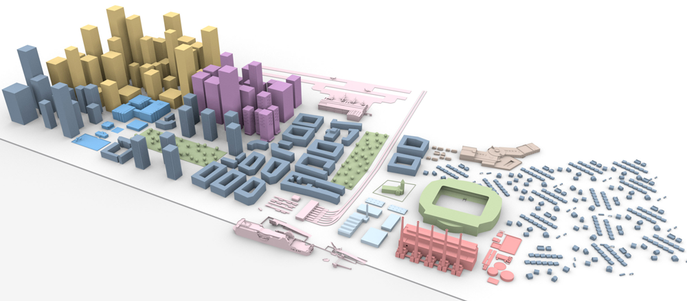
2. Enter by urban object type
(Hover over different land uses below)
(Hover over different land uses below)

3. Enter by a specific keyword/crime type
(And see top right of screen)
(And see top right of screen)
Search by specific keyword: